
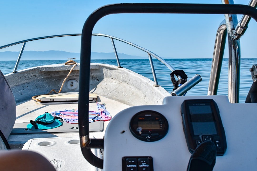
What Happens To Navigation When A Boat Leaves Mobile Coverage?
The coastline is still visible when the phone loses its signal. The chart remains on screen, the position marker continues to move and, for a while, nothing appears to have changed. Then the weather overlay stops updating, messages remain unsent and the marina details someone expected to check later are no longer available. Losing mobile coverage does not mean losing navigation. GPS, onboard chartplotters, AIS and marine radio operate independently of a phone’s cellular connection. What disappears is the layer of live information that has made boating feel increasingly similar to travelling on land: current forecasts, cloud-based route planning, messaging, traffic services and instant access to local information. For a day boat remaining close to shore, the interruption may be little more than an inconvenience. On an island crossing or a longer coastal passage, it can expose how much of the plan depended on services that were never designed to be available everywhere at sea.
GPS continues working without a mobile signal
A phone or tablet can receive its position from navigation satellites without connecting to a cellular network, provided the device contains a suitable GPS receiver. The familiar location marker may therefore continue following the boat even after calls and mobile data stop working. This often creates the impression that the entire navigation app remains fully functional. In reality, only the information already stored on the device is guaranteed to remain available. The GPS can determine where the boat is, but it cannot download a chart that was never saved, retrieve a new forecast or look up an unfamiliar harbour once the internet connection has disappeared. Some devices also depend more heavily on mobile networks than their owners realise. Certain tablets, particularly Wi-Fi-only models, may not include an internal GPS receiver. A phone may use cellular and Wi-Fi information to establish its initial position more quickly, even though satellite positioning itself does not require mobile service. Before relying on a device at sea, the operator should know where its position is coming from and whether the required charts remain available in flight mode. The easiest test is conducted at home or at the marina, not after the coastline begins to fade.
Downloaded charts are different from online maps
A marine navigation app can work beyond mobile coverage when the relevant chart area has been downloaded in advance. Coastlines, depths, buoys and other charted information remain stored on the device, allowing the GPS position to be shown against them. An online map behaves differently. It may display the current area while a connection is available, then leave blank sections or low-detail images when the user moves beyond the portion held temporarily in the device’s memory. A screenshot of a route is not a navigational chart and cannot provide the detail required to identify shallow water, restricted areas or navigational marks. Even properly downloaded charts need to cover more than the intended line of travel. Weather, congestion or a mechanical problem may require the boat to enter another harbour or take a different route. A narrow strip saved around the original plan offers little protection when the plan changes. The chart package should include the departure area, the complete route, possible alternatives and the approaches to any harbour that could reasonably be used. Updates should be installed before departure while a dependable connection is still available.
The phone may know the position without knowing what is happening around it
A GPS position answers one important question: where is the boat? It does not reveal every vessel nearby, explain why a ferry has altered course or show whether another boat is likely to pass dangerously close. AIS can add part of that information. An onboard receiver picks up broadcasts from equipped vessels through marine radio frequencies rather than mobile data. Depending on the installation, the operator may see a vessel’s name, position, direction and speed on the chartplotter. A transmitting unit also broadcasts the boat’s own information to other AIS users. This exchange can continue outside cellular coverage because it takes place directly between vessels and compatible stations. The practical range depends on antenna height, equipment and surrounding conditions rather than the presence of phone towers. AIS remains incomplete. Many small recreational boats do not transmit, and swimmers, paddleboards, floating debris and numerous other hazards will never appear as targets. Incorrectly entered or delayed information can also make a vessel appear different from its actual situation. The display supports the lookout; it does not replace it.
Marine radio becomes more important as the phone becomes less useful
Mobile phones have encouraged boaters to treat communication at sea as an extension of ordinary life. A marina can be called, friends can receive a message and emergency services appear to be only a familiar number away. Offshore, that confidence can vanish quickly. A fixed or handheld VHF marine radio communicates through dedicated maritime channels. It can reach nearby boats, harbour authorities, coast stations and rescue services within radio range. Because other vessels can hear a distress or safety call, VHF offers something a private phone conversation does not: communication with the wider maritime community around the boat. A properly configured radio with digital selective calling can transmit a distress alert linked to the vessel’s identity and position. That function depends on correct installation, an assigned maritime identity number and a GPS connection. Equipment that has never been configured or explained during the handover may offer less protection than the renter assumes. The radio should be switched on and monitored before it becomes urgently necessary. Renters also need to know which channel is used for calling, which local working channels apply and how to issue a distress or urgency message. A radio stored in a locker with a depleted battery provides little reassurance.
Mobile coverage rarely ends at a clear line
The phone does not always move neatly from full service to no service. A weak signal may appear and disappear as the boat travels around headlands, between islands or further from shore. The device can show coverage while data transfers fail or calls break up. This inconsistency can be more misleading than a complete loss of service. A weather page may display information retrieved earlier without making the age of the update obvious. A message may appear to have been sent while remaining queued on the device. Route changes stored in the cloud may not reach another member of the group. Applications also behave differently when connectivity weakens. Some retain charts and route information cleanly; others continue attempting to load data and become slow or difficult to use. Battery consumption can increase as the phone searches continuously for a network. Airplane mode with GPS re-enabled may preserve power when cellular coverage is clearly unavailable, although the settings should be tested before the trip. The operator must also remember that changing modes can affect calls, messages and connected accessories.
Weather becomes a stored forecast rather than a live service
A forecast downloaded in the morning describes the conditions expected at that time. It does not update itself when a front accelerates, thunderstorms develop or a local warning is issued. Close to shore, a phone may reconnect frequently enough for this distinction to go unnoticed. During a longer passage, several hours can pass between updates. Conditions may still match the forecast, but the crew should understand that the information is ageing.
Marine radio broadcasts, onboard satellite services and dedicated weather receivers can provide information outside cellular range, depending on the region and equipment. Visual observation also remains important. Wind direction, cloud development, visibility and changes in sea state may reveal that conditions are departing from the plan before a digital update becomes available. The itinerary should not depend on receiving one more forecast after departure. The crew needs enough information to complete the passage safely, identify suitable alternatives and turn back when conditions deteriorate. Live data is valuable, but a route that becomes unsafe without continuous internet access was poorly prepared from the beginning.
Satellite communication fills some of the gap
Satellite services allow messages, tracking information and weather data to travel beyond the reach of terrestrial networks. Some systems use a dedicated terminal installed on the boat, while compact communicators can pair with a phone and send short messages through a satellite network. For a coastal day rental, this level of equipment may be unnecessary. A boat travelling between distant islands, along an isolated coast or beyond dependable VHF contact has a stronger case for it. The decision should reflect the route and the consequences of losing ordinary communication rather than the novelty of the device. Satellite communication is not the same as uninterrupted mobile internet. Coverage, antenna position, subscription terms and the surrounding environment affect performance. Messages may take time to send, large downloads may be impractical and some functions require a clear view of the sky. The phone may still provide the interface, but the connection behind it has changed. Users need to activate the service, pair the devices and practise sending a message before departure. Discovering that an emergency feature requires an unfinished registration process is not a problem that should occur at sea.
Emergency beacons solve a different problem
A satellite communicator is useful for routine messages, tracking and two-way contact. An emergency position-indicating radio beacon, or EPIRB, is designed specifically to alert rescue authorities when a vessel is in serious distress. A personal locator beacon performs a similar function for an individual. These devices should not be treated as interchangeable with mobile phones, AIS or navigation apps. Their purpose is not route planning or ordinary communication. When activated correctly, a registered beacon sends an emergency signal and position information through a dedicated search-and-rescue system. Registration matters because it connects the beacon’s identity with the vessel or owner and provides rescuers with useful contact information. Battery expiry dates and mounting arrangements also require attention. An emergency device hidden beneath other equipment or unfamiliar to everyone aboard loses much of its value. Renters planning more exposed routes should ask which distress equipment is carried, where it is located and who is expected to activate it. A safety briefing that lists equipment without demonstrating it leaves a dangerous gap between possession and use.
Cloud-based route planning needs an offline counterpart
Planning a trip on a larger screen before transferring it to the boat’s display is convenient. Routes, waypoints and favourite locations can be synchronised across devices, while marina details and notes remain available to everyone in the group. The weakness appears when the final version exists only in a cloud account. A failed synchronisation, forgotten password or lost connection may leave the helm without the route that was prepared the night before. Essential information should be stored locally on the navigation device used aboard. The route should also remain understandable without the app that created it. Departure point, destination, important waypoints, hazards and alternative harbours can be recorded separately rather than entrusted to a single account or device. The same principle applies to booking information. Marina reservations, the boat owner’s telephone number, fuel arrangements and emergency contacts should be saved where they can be opened offline. A screenshot may be entirely appropriate for this administrative information, even though it is unsuitable as a substitute for a navigational chart.
Power becomes part of the navigation plan
A phone with downloaded charts and an internal GPS may continue working perfectly without cellular coverage until the battery runs out. Navigation apps, bright screens, Bluetooth connections and repeated searches for a mobile network can consume power quickly. The boat’s charging system may appear to solve the problem, but renters should confirm which outlets work while underway and whether charging cables or adapters are provided. A boat may offer USB ports in the cabin while the device is needed at the helm. Saltwater and exposed connectors create another source of failure. A waterproof power bank provides a useful reserve, although it should not become the only backup for the boat’s primary navigation equipment. Devices can overheat in direct sunlight, shut down unexpectedly or become unreadable when wet. Dedicated chartplotters generally offer a more robust installation because they are connected to the boat’s electrical system and positioned for use at the helm. They remain dependent on the vessel’s batteries, wiring and sensors, which is why basic power management still matters on longer passages.
One device should not carry the entire trip
A phone can contain the chart, route, weather forecast, marina reservation, emergency contacts and communication apps. That efficiency becomes a vulnerability when the device is dropped, overheats or loses power. A tablet may offer a larger backup display, although two devices using the same account, chart source and charging cable do not provide complete independence. A failure in the app or subscription can affect both. The appropriate level of redundancy depends on the trip. A short rental within a sheltered bay may need little more than the boat’s chartplotter, a charged phone and a clear briefing. An offshore passage calls for independently stored charts, dependable radio communication, spare power and a route that can still be followed when one system fails. Paper charts remain useful on some voyages, particularly when the crew knows how to use them. Carrying one without the necessary plotting tools or navigational understanding offers symbolic rather than practical backup. The wider principle is more important than the format: no single failure should leave the operator unable to determine the boat’s position or reach assistance.
The handover should include the moment connectivity disappears
Boat briefings often concentrate on starting the engine, handling lines and locating safety equipment. The navigation discussion may end after the chartplotter is switched on. Renters should ask whether mobile coverage is dependable along the intended route, which onboard systems continue working without it and how the boat communicates offshore. They need to know whether AIS is receive-only or transmitting, whether the VHF radio has digital distress capability and whether any satellite device requires a personal subscription or paired phone. The owner or captain should also explain how the chartplotter shows position, how to return to the departure point and what happens if the display stops receiving GPS information. A short practical demonstration is more valuable than being told that the boat has “all the latest technology”. Passengers should know the essentials as well. If the person operating the boat becomes incapacitated, someone else should be able to reduce speed, identify the position, use the radio and call for help.
Not every loss of signal requires more equipment
There is a tendency to answer every technological limitation with another device. For many rentals, better preparation is more useful than a larger electronics inventory. A day boat staying within familiar coastal waters may retain VHF contact and onboard navigation throughout the trip even when phones briefly lose service. Downloading the chart, storing the forecast, carrying sufficient power and knowing the return route may be entirely adequate. Longer passages require more. The point at which satellite communication, transmitting AIS or a registered emergency beacon becomes appropriate depends on distance from assistance, traffic, weather exposure and the experience of the crew. The boat owner can explain the installed equipment, but the renter remains responsible for choosing a trip compatible with their ability. Technology cannot make an offshore route suitable for someone who would be unable to continue safely after the phone stops working.
Navigation becomes simpler when its systems are understood separately
Mobile coverage has bundled several different functions into one familiar screen. Positioning, charts, weather, messaging and local information appear to belong to the same service because they are accessed through the same phone. At sea, their independence becomes visible. GPS can continue while the internet disappears. A downloaded chart can remain while the weather overlay freezes. AIS and VHF can operate through marine radio frequencies, while satellite equipment provides another path for communication. Each system answers a different need and fails in a different way. A boat does not become unnavigable when it leaves mobile coverage. It becomes less forgiving of assumptions. The crew that has downloaded the correct charts, stored essential details, checked the forecast and understood the onboard equipment may notice little more than a quiet phone. The crew that expected every service to remain live discovers the difference only when it tries to retrieve something important. Leaving coverage should therefore be part of the plan rather than an unexpected event. The coastline may still be visible when the signal disappears, but the preparation for that moment begins before the boat leaves the dock.


